 button. The following list provides an overview of each gridding method and some advantages and disadvantages in selecting one method over another.
Gridding Methods
Grid method parameters control the interpolation procedures. When you create a grid file, you can usually accept the default gridding method and produce an acceptable map. Different gridding methods provide different interpretations of your data because each method calculates grid node values using a different algorithm. If you are not satisfied with the map of your data, you might consider producing grid files using several different gridding methods and comparing the results.
Because Surfer maps are created from gridded data, the original data in Didger are not necessarily honored in the grid file. When you post the original data points on a contour map, some of the contour lines might be positioned in a position relative to the original data that appears differently than you might draw the line. This happens because the locations of the contour lines are determined solely by the interpolated grid node values and not directly by the original data. Some methods are better than others in preserving your data, and sometimes some experimentation (i.e. increasing grid density) is necessary before you can determine the best method for your data.
Gridding methods are selected in the Grid Data dialog. To open the Grid Data dialog, click the Map | Surfer | Grid Data command or click the button. The following list provides an overview of each gridding method and some advantages and disadvantages in selecting one method over another.
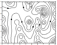
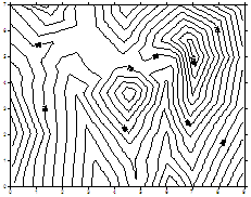
Inverse Distance to a Power is fast but has the tendency to generate "bull's-eye" patterns of concentric contours around the data points and does not extrapolate Z values beyond the range of data.
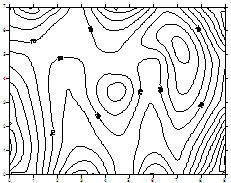
Minimum Curvature generates smooth surfaces and is fast for most data sets but it can create high magnitude artifacts in areas of no data. The internal tension and boundary tension allow you control over the amount of smoothing. Minimum Curvature can extrapolate values beyond your data's Z range.
Nearest Neighbor is useful for converting regularly spaced (or almost regularly spaced) XYZ data files to grid files. When your observations lie on a nearly complete grid with few missing holes, this method is useful for filling in the holes, or creating a grid file with the blanking value assigned to those locations where no data are present. Nearest Neighbor does not extrapolate Z grid values beyond the range of data.
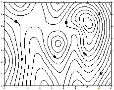
Radial Basis Function is quite flexible. It compares to Kriging since it generates the best overall interpretations of most data sets. This method produces a result quite similar to Kriging.
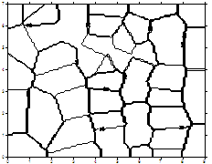
Triangulation with Linear Interpolation is fast. When you use small data sets, Triangulation with Linear Interpolation generates distinct triangular faces between data points. Triangulation with Linear Interpolation does not extrapolate Z values beyond the range of data.
See Also