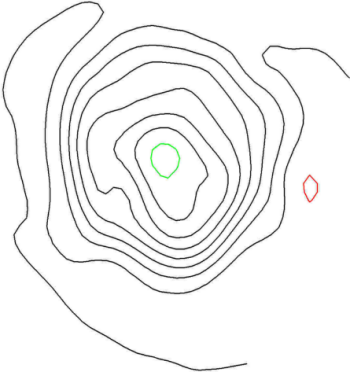
The Image | Vectorize Image command converts a raster image into a vectorized data set of polylines and polygons. In the vectorize image example, we will use an image containing contours and automatically create vector lines of those contours. Once the contour lines are created, we will automatically assign elevations to the polylines.
Tutorial VLines.pjt contains a
simple contour map from which we
can create vector polylines automatically.
The following sections are included in Lesson 7 - Vectorizing an Image:
Opening an Existing Project File
Automatically Creating Vector Contour Lines
Back to Download the Online Map
Next to Opening an Existing Project File