Click
the Image | Download Online Maps
command or click on the  button.
In
the Download Online Maps dialog,
click the ![]() next to the Imagery
section in the Select Data Source
box.
next to the Imagery
section in the Select Data Source
box.
Click
the ![]() next to NAIP Color Imagery for US
to open the NAIP group.
next to NAIP Color Imagery for US
to open the NAIP group.
Click on USGS_EROS_Ortho_NAIP to select the NAIP map web server.
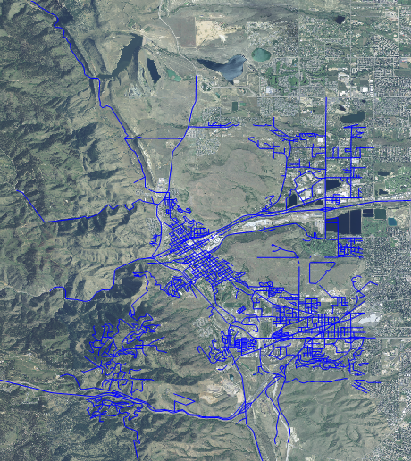
In the Select Area to Download section, the Specify Latitude/Longitude extents is automatically selected. This sets the limits based on the previously defined map extents. The image will be limited to the area determined by the Golden_Roads.shp file that was previously imported.
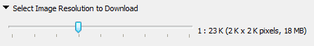
In the Select Image Resolution to Download section, drag the slider to the right to increase the image resolution. The farther to the right the slider is located, the better the resolution and the larger the image. Clicking on one of the lines on the left side of the slider downloads a map of sufficient quality that is smaller in size.
 button.