Didger® is a digitizing and coordinate conversion software. You can digitize maps, aerial photographs, graphs, or any other data with Didger. When working with your project, you can digitize onscreen with your computer's mouse, or digitize directly from a paper copy using a digitizing tablet.
Didger provides extensive flexibility in working with your data. You can import image files, data files, or vector files directly into Didger. Didger supports multiple layers to help organize your project, georeferencing images, image warping (rubber sheeting), combining georeferenced images into a new image, overlaying vector, data, and georeferenced images on each other, easily adding graticule or grid lines to your project, and associating many different attritubtes to each object. Didger also includes comprehensive editing tools for creating and editing objects and images.
Data transformation and coordinate conversion capabilities, in addition to Golden Software's comprehensive map projection library, easily permits reprojection or recalibration of data into almost any coordinate system. You can assign or change the projection of any imported vector map, imported image, or objects drawn on the project page. Then, change the projection, coordinate system, or datum. Or, create your own custom datum. Didger 5 is fully compatible with other software. It imports and exports data, vector, and raster files in the most popular formats.
With Didger, you can easily draw objects
with a mouse or a digitizing tablet.
The following are a few examples of ways to use Didger.
Digitize contour maps from topographic sheets or hand drawn maps
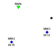
Obtain data from graphs, such as well logs, when you do not have the original data
Digitize sample locations, such as oil and gas wells, and associate it with data
Digitize boundaries such as township and range lines or property boundaries
Georeference aerial photographs, satellite images, or paper documents
Warp images to show their true scaling
Digitize points, polylines, or polygons from aerial or satellite photographs
Digitize radiation dose calculations from patient films in the medical industry
Map archeological sample sites from field maps
Digitize geological information from paper maps, aerial photos, or hand-drawn cross sections
Digitize road and street maps to obtain route length information
Digitize wildlife study information such as migratory areas for birds and other animals
Digitize vegetation boundaries, burn areas, restoration projects, and lumbering areas
Determine the area under a curve of a printed graph
Resample well log data on regular intervals
Digitize seismic section lines with shot point locations
Create spreadsheet files for data analysis
Create Surfer base maps in one step
Merge vector files, georeferenced images, and data files from various data sources into one project
The minimum system requirements for Didger are:
Windows XP SP2 or higher, Vista, 7, 8, or higher
Minimum 1024x768 or higher monitor resolution with 16-bit color depth
At least 500 MB of free disk space, 10 GB for advanced image processing
At least 512 MB RAM above the Windows system requirements for simple data sets, 2 GB recommended for advanced image processing
Digitizing tablets are optional hardware items that can be used with Didger.
See Also
Getting Base Information into Didger