Didger allows you to convert symbol, polyline, polygon, text, and image objects from your paper documents or imported files into digital format. Every object digitized or imported into Didger has associated XY coordinates that define the object location and can have up to 256 associated attributes. These attributes can be used to assign names, data, or any type of descriptive text to an object.
Didger objects are represented in your project using special drawing properties, such as fill patterns and color. You can control the properties with the Property Manager for each object you create.
Symbols
Symbols are isolated locations that indicate objects such as well locations, sample locations, benchmarks, and so on. In Didger, polygon markers are a special type of symbol. Post maps, created by importing a data file, also consist of symbols.
The IDs associated with symbols can provide information such as:
well names
technician name
contamination levels
water depth
elevation
sample number
date of sample
assay value
porosity
or any other type of data
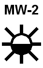
This is a symbol with a label.
Polylines indicate objects such as roads, streams, contours, township and range lines, or partial area boundaries such as county or state boundaries that might pass through a map area. A polyline consists of one or more line segments joined end to end. Polylines, unlike polygons, are not closed. The beginning and ending points of a polyline are called nodes, and the intermediate ends to each line segment are called vertices. Polyline nodes are displayed as green (beginning) and red (ending) boxes when the Show Line Nodes box is checked in Tools | Project Settings | Tolerance Settings. Polylines are also called curves or lines. In Didger, spline polylines and wrapped polylines are special types of polylines.
The IDs associated with polylines can provide information such as:
road name
stream name
stream flow for stream segments
contour value (elevation)
township or range indicators
and so on
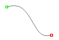
This is a polyline displaying line nodes.
Polygons are closed shapes such as county or state boundaries, project areas, and claim boundaries. Polygon perimeters are defined by a series of straight-line segments joined end to end. A polygon contains at least three line segments, and the beginning of the first line segment is joined to the end of the final line segment to achieve closure. Vertices define the end of each straight-line segment along a polygon. In Didger, rectangles, circles, and spline polygons are special types of polygons.
The IDs associated with polygons can provide information such as:
county or state name
area name
number of samples or wells in an area
claim number
claim ownership
and so on
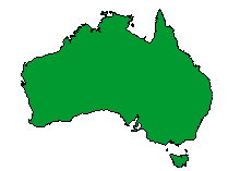
This is an example of a filled polygon.
Text is defined as an object type in Didger and, unlike labels, text is not directly associated with other object types. Text objects are created for display purposes and are not generally used for analysis. The information stored for text includes a text string, the location at which it is displayed, and text properties (color, font, size, etc.).

This is an example of a text object.
An image is displayed as an array of dots or pixels. There are two ways of storing, representing, or displaying spatial data in digital form: images and vector data. Images, such as . JPG or .GIF, are displayed as an array of dots or pixels and contain information on each and every pixel. The resolution of an image changes when the image is resized or stretched.
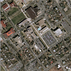
This is an image displaying an urban area.
See Also
Digitizing Several Objects with Different IDs